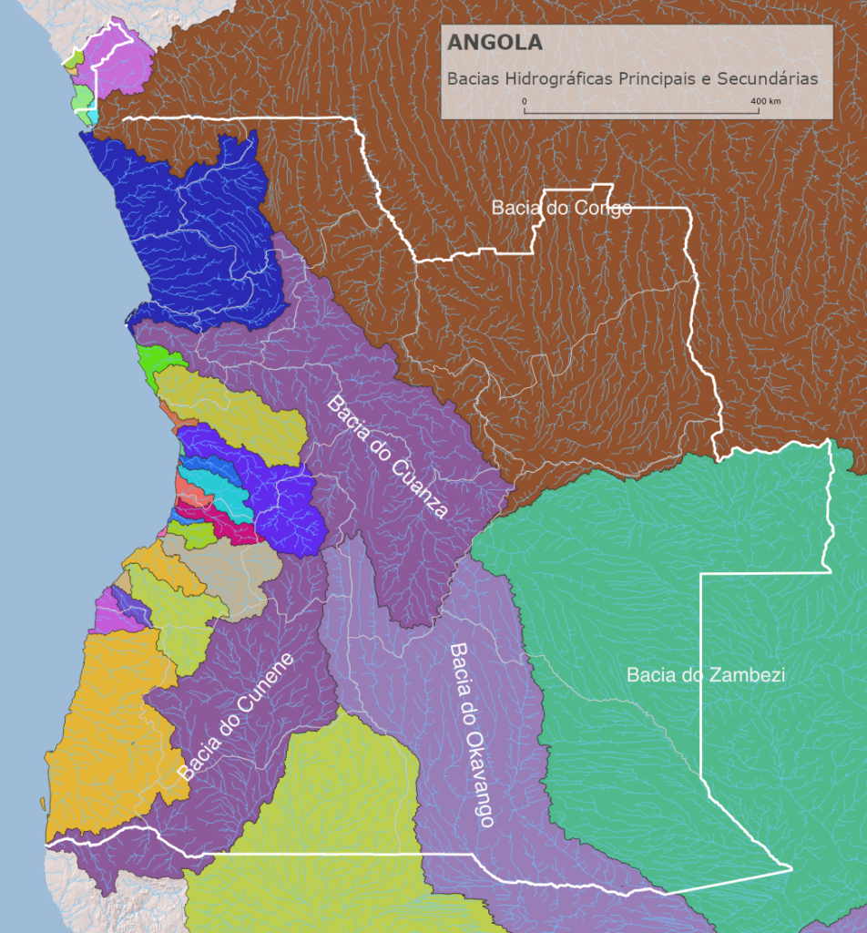
Surface water resources in Angola are considered for the different river basins in Angola, ranging from 1,000 square kilometres of shared water to the 3.7 million square kilometres like for the Congo Basin. This major basin supplies water to the populations of 10 countries before flowing into the Atlantic Ocean.
While the financing of water resources development is often defined by administrative boundaries, the management and equitable sharing of water has to be organised at river basin level, which in some cases transcends administrative boundaries.
All surface water resources in Angola are located within the country's national border. Only the province of Cabinda has water coming from a neighbouring country.
On this site, access to data related to the assessment and development of water resources can be obtained within administrative boundaries (in the main categories, "province") and at basin level (in the main category "basin").
O mapa abaixo mostra as bacias principais e as bacias hidrográficas independentes mais pequenas. Apenas as bacias com importância económica serão analisadas e actualizadas. As imagens de pormenor destinadas a verificar a irrigação e as zonas potenciais de expansão são, por enquanto, demonstrado for Benguela Province. A detailed analysis of the river basins and their sub-basins can be found in the "Basin" menu.
Map 1.: Major River Basins and Sub-basins of Angola
